The Dong Van Karst Plateau: Ha Giang's High Ground
What is the Dong Van Karst Plateau and is it a separate destination from Ha Giang?
The Dong Van Karst Plateau is the high, rugged northern section of the Ha Giang loop, not a separate place you can reach on its own. It is a UNESCO Global Geopark spanning four districts, known for grey limestone peaks, terraced fields wedged into rock crevices, and villages of the Hmong, Tay and other ethnic minorities. Most visitors experience it as one to two days within a longer motorbike or jeep loop out of Ha Giang town.
Where the Dong Van Plateau Fits on the Map
Say “Dong Van” to anyone who has ridden the Ha Giang loop and they will picture the same thing: grey limestone peaks stacked to the horizon, a two-lane road cut into a cliff face, and small stone-walled villages tucked into folds of rock that look too steep to farm. That image belongs to the Dong Van Karst Plateau, a stretch of high ground in the far north of Ha Giang province, hard against the Chinese border.
It is worth being precise about what the plateau actually is, because it is easy to picture it as a standalone destination the way Sapa or Ha Long Bay are. It is not. The Dong Van Karst Plateau is a section of the wider Ha Giang loop, the multi-day route that begins and ends in Ha Giang town and threads through several districts of the province. Dong Van district and the plateau it sits on are the loop’s high point, both literally and in the sense that most riders consider it the most dramatic day of the trip.
But there is no way to arrive at the plateau without first travelling the same roads as everyone doing the full loop, and no separate entrance or gateway town that bypasses the rest of the route. If you are planning a trip, the practical route details, day-by-day structure and timing belong on the Ha Giang loop guide and the dedicated 3-4 day loop itinerary; this page is about understanding the plateau itself, so you know what you are looking at once you are up there.
The plateau is officially recognised as a UNESCO Global Geopark, a designation given to areas of exceptional geological heritage managed for conservation and community benefit. That is a different, less well known category than the UNESCO World Heritage listing given to sites like the Trang An Landscape Complex further south, and the two are sometimes confused. The geopark status reflects the plateau’s karst limestone formations, which are genuinely old and genuinely dramatic, but it does not come with the visitor infrastructure or fixed ticketing of a World Heritage attraction. Much of what makes the plateau worth visiting is the drive itself and the villages along the way, not a single ticketed site.
A Landscape Shaped by Limestone
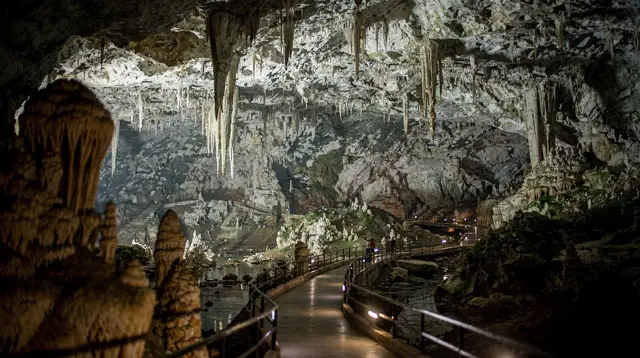
The Dong Van plateau sits within a broader karst region that extends across several districts of Ha Giang province. Karst landscapes form where limestone bedrock dissolves unevenly over long stretches of geological time, leaving behind the jagged peaks, sheer cliffs, sinkholes and cave systems that define the terrain here. Compared with the wetter, greener karst of Ninh Binh or Trang An further south, the Dong Van plateau is starker and more exposed: grey rock predominates, tree cover is thinner at altitude, and the fields that do exist are often wedged directly into cracks and hollows in the stone rather than spread across open valley floors.
That last detail is one of the more striking things about the region once you notice it. Farmers here have adapted to a landscape that offers very little flat, soil-covered ground, carrying earth into rock crevices by hand to create small plots for maize and other hardy crops. It is a different kind of agricultural ingenuity from the famous rice terraces of Sapa or Mu Cang Chai, which rely on abundant water and gently sloped valleys; up here the constraint is stone itself, not water.
The plateau’s elevation also shapes its climate, and this is worth being honest about rather than reaching for a specific number: conditions vary meaningfully by exact location and season, and temperature figures you will see quoted online are not always reliable or current.
What can be said with confidence is that the plateau runs noticeably cooler than Hanoi year-round, that winter mornings bring fog and a real chill that catches underprepared riders off guard, and that road conditions can turn quickly in poor weather. Anyone planning a visit should check current conditions close to their travel dates rather than trusting a fixed figure from an old source; our motorbike season and fog guide covers this in more depth.
The Road Through the Mountains
The single most photographed stretch of the plateau is the road connecting Dong Van town to Meo Vac, known as the Ma Pi Leng Pass. It climbs along the flank of the mountains above the Nho Que River, which runs a striking turquoise-green far below in a canyon it has carved over a very long stretch of geological time. The pass has no fixed viewpoints in the way a national park might, and travellers tend to stop wherever the road offers a clear line down to the river and across to the opposite ridge, rather than at a single designated overlook.
Riding or being driven along this stretch is, for many visitors, the single reason the wider loop has the reputation it does. Guided operators who run the pass regularly, and who can read the road and weather conditions on any given day, are a sensible choice for travellers who are less confident on a motorbike or who would simply rather look at the view than watch the tarmac. A tour built specifically around this section, such as the guided day trip along Ma Pi Leng Pass and down to the Nho Que River, covers the pass together with a boat ride on the river itself, which gives a very different, ground-level perspective on the same canyon.
The pass is one dramatic stretch within a longer route, though, and it is worth resisting the temptation to treat it as the only reason to be here. The roads on either side, connecting Dong Van town to Yen Minh and onward toward the rest of the loop, pass through their own sequence of villages, markets and smaller viewpoints that many riders remember just as fondly once the trip is over.
Villages and the People Who Live Here
Ha Giang province as a whole, and the Dong Van plateau in particular, is home to a number of ethnic minority groups whose presence shapes daily life on the road far more than any single monument does. Hmong communities are the most visible across much of the plateau, recognisable by traditional dress that varies by subgroup and by the distinctive stone-walled compounds built to withstand the wind and cold at altitude. Tay and Dao communities are also present, more concentrated in certain valleys, and house styles, festival dates and even the crops grown shift noticeably as the road moves between them.
This is one of the plateau’s genuine strengths as a destination: it rewards slow travel through inhabited landscape rather than a checklist of sights. A short walk off the main road, arranged with a local guide who knows a particular village, tends to reveal far more than another photo stop on the highway. Operators running the guided trek to ancient villages with a picnic lunch included build a day specifically around this kind of village-level access, walking between settlements rather than only riding past them, which suits travellers who want the plateau’s human side as much as its geology.
Markets are another point of genuine cultural contact. Weekly markets rotate through towns across the district, drawing in families from surrounding villages to trade produce, livestock and household goods, and they remain functioning local markets rather than staged events, even as they have become a fixture on tour itineraries. Timing a visit around a market day, where the schedule allows, adds a layer to the trip that a simple drive-through cannot. A tour such as the Dong Van market fair tour with a local guide is built around exactly this, pairing a market visit with orientation to the town and its history.
Dong Van town itself, the plateau’s main settlement, has a small historic quarter with older buildings that hint at its past as a trading post close to the Chinese border, along with a well-known clan house associated with a locally influential family from the early twentieth century. It is a natural overnight stop for most loop itineraries and a good base for exploring the surrounding villages on foot before continuing toward Meo Vac.
Choosing How to Experience the Plateau
There is no single correct way to see this part of Ha Giang, and the right choice depends heavily on riding experience, time and appetite for organising logistics yourself.
| Approach | Who it suits | What it involves |
|---|---|---|
| Self-drive motorbike | Confident, experienced riders | Renting your own bike, navigating and pacing the route yourself |
| Easy rider (pillion) | Travellers who want the ride without driving | A local rider drives, you sit behind and take in the views |
| Guided motorbike tour | Riders who want structure and safety support | Small group or private tour with a lead rider and support vehicle |
| Private jeep or car | Travellers uneasy on two wheels | Comfortable seating, same route, less exposure to weather |
For travellers weighing up whether to ride themselves at all, our self-drive versus easy rider guide goes into the practical trade-offs, including licensing and insurance considerations covered separately in our motorbike licence and insurance guide.
For those who have decided a fully guided option suits them best, a structured multi-day tour such as the 3-day Ha Giang loop covering Dong Van, Ma Pi Leng and Du Gia or the 2-day Dong Van trekking tour with a local homestay removes the need to plan the route, arrange fuel stops or navigate unfamiliar mountain roads, while still spending nights in the district rather than passing through on a single long day.
Whichever approach you choose, the plateau is genuinely not a place to rush. The roads are narrow, frequently shared with livestock, and can be affected by fog or rain with little warning, so building in slack time matters more here than on most of the routes covered elsewhere on this site. If your interest is really in the fuller route rather than this one section, the Ha Giang loop guide and the 3-4 day itinerary are the better starting points; treat this page as background on the ground you will be covering once you get there, not as a substitute for the route planning itself.
Practical Notes Before You Go
A handful of things are worth checking rather than assuming. Parts of Ha Giang province close to the Chinese border have historically required a local travel permit for foreign visitors, generally arranged on your behalf by a tour operator or a guesthouse in Ha Giang town rather than something you apply for independently in advance; confirm the current situation with whoever is organising your trip before you set out, since rules in border areas can change.
Mobile coverage across the plateau is inconsistent, particularly around the passes, so download offline maps and let someone know your rough plan for the day. Fuel stations thin out the further you get from Ha Giang town and Dong Van itself, another reason a guided or supported option appeals to many first-time visitors to the area.
Finally, resist the urge to plan the plateau as a list of timed viewpoints. The roads, the weather and the pace of village life here do not run to a schedule, and the travellers who tend to come away happiest are the ones who left room for a slower lunch, an unplanned stop at a market, or simply riding a little further before turning back for the night.
Dong Van Plateau: Frequently Asked Questions
Is the Dong Van Karst Plateau a UNESCO World Heritage Site?
No. It is recognised as a UNESCO Global Geopark, a different designation that protects geological heritage and supports community-based tourism, not a World Heritage Site.
Can I visit Dong Van without doing the full Ha Giang loop?
Not really. The plateau is a section of the loop reached by the same mountain roads everyone else uses, whether on a rented motorbike, an easy rider’s bike, a private jeep, or a multi-day organised tour. There is no separate shortcut in.
How high is the plateau and how cold does it get?
It is genuinely mountainous and noticeably cooler than Hanoi, with cold, often foggy conditions in winter. Exact altitude and temperature figures vary by source and by exact location, so check current conditions before travelling rather than relying on a single number.
Which ethnic groups live on the plateau?
The plateau and its districts are home to several minority groups, most visibly Hmong communities, alongside Tay, Dao and other groups depending on the valley. Villages, markets and house styles vary noticeably over short distances.
What is the Ma Pi Leng Pass and is it part of Dong Van?
Ma Pi Leng is the mountain pass connecting Dong Van town to Meo Vac, cut into the flank of the plateau above the Nho Que River. It is usually treated as the dramatic centrepiece of a Dong Van visit rather than a separate stop.
Do I need a permit to visit this area?
Parts of Ha Giang province, including areas near the Chinese border, have historically required a local travel permit, typically arranged by a tour operator or guesthouse rather than by the traveller directly. Confirm current requirements with your operator or accommodation before setting out.
Is a motorbike necessary, or can I see the plateau another way?
A motorbike is the classic way to experience the loop’s viewpoints and passes, but it is not the only option. Jeep tours, easy rider pillion trips and multi-day guided tours all reach the same roads for travellers who prefer not to ride themselves.
Motorbike Loops and Countryside Excursions
Verified deep-linked GetYourGuide tours. Book through these links and we earn a small commission at no cost to you.
GetYourGuide does not provide a product photo for this activity — the image shows the meeting point, photographed by us.