Mobility and Accessibility in Northern Vietnam
Is northern Vietnam accessible for travellers with reduced mobility?
It is uneven and inconsistent rather than uniformly hard or easy. Central Hanoi has narrow, motorbike-clogged pavements and few curb cuts, Ninh Binh's karst sites involve steps and unramped boat boarding, and Sapa or Ha Giang add steep, broken terrain. A few modern hotels and one metro line are genuinely accessible; most historic sites, boats and rural roads are not.
What actually limits mobility here
Northern Vietnam was not built, and in most places has not been retrofitted, with wheelchairs, walkers or limited stamina in mind. That is true of a fast-growing capital as much as of a rural karst valley, and it plays out differently from one street or site to the next. This page is about the physical obstacles themselves — pavements, steps, boats, terrain — not about which activities happen to work around them; for that, see the companion guide to accessible activities in northern Vietnam.
The point worth holding onto before anything else: a hotel with a lift and a step-free shower says nothing about whether the temple, boat dock or viewpoint a ten-minute walk away is reachable. Accommodation and site access have to be checked separately, site by site, not assumed from one to the other.
Hanoi: pavements, parking and crossings
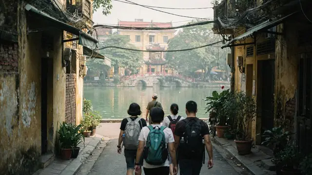
In Hanoi, and especially in the Old Quarter, the pavement is rarely a clear path. It is used for motorbike parking, street food stalls, parked bicycles and shopfront displays, often all at once, which pushes pedestrians into the road on streets that were never wide to begin with. Where a pavement does stay clear, it is frequently narrow, cracked, or set a step above the road with no ramped edge. Curb cuts exist in places but are not consistent, and a route that looks fine on a map can turn into a block of unbroken high curb with no alternative.
The wider grid around Hoan Kiem Lake and through the French Quarter has broader pavements and gentler crossings than the Old Quarter’s 36 streets, which makes it a more forgiving base for slow, careful walking, though it is not level or obstacle-free either. Crossing any Hanoi street, on foot or in a wheelchair, means moving at a steady, predictable pace through moving motorbike traffic rather than waiting for a gap that clears — a method that demands confidence and adds a genuine safety consideration for anyone who cannot move quickly if a gap closes faster than expected.
Getting around Hanoi mostly means ride-hailing cars, taxis and buses, none of which are reliably step-free, plus a small but useful metro network. Line 2A (Cat Linh–Ha Dong) and the elevated section of Line 3 (Nhon–Hanoi Station), which opened in 2021 and 2024 respectively, have lifts at most stations — genuinely more than can be said for the street network feeding into them.
The harder part is often reaching the station entrance itself across the pavement conditions described above. Noi Bai Airport, 25–35 km north of the centre, has standard modern-airport infrastructure inside the terminal, but there is no rail or metro link, so the 45–70 minute road transfer depends on the vehicle booked rather than on the airport.
Central Hanoi’s sights: a site-by-site picture, not one answer
Ba Dinh district illustrates the inconsistency well. The grounds around the Ho Chi Minh Mausoleum are large, paved and relatively flat, with long approach walks but few steps. A short distance away, the Temple of Literature — Vietnam’s first university, founded in 1070 — is a sequence of courtyards linked by raised stone thresholds and, in places, uneven paving that has settled unevenly over centuries.
The One Pillar Pagoda is a small structure reached by steps with no ramp. Thang Long Imperial Citadel, a UNESCO World Heritage site since 2010, mixes open excavated ground, gravel paths and steps into the underground bunker sections, which are not step-free by nature.
Hoa Lo Prison involves stairs between floors and narrow original corridors that were not built for wide passage of any kind. The Vietnam Museum of Ethnology is more forgiving indoors, with level galleries, but its outdoor grounds — where full-scale ethnic minority houses are displayed on stilts — involve staircases up into the houses themselves. None of this adds up to a single verdict on “Hanoi’s museums” or “Ba Dinh”: each site has to be judged on its own layout.
Ninh Binh: steps, karst and boats with no ramp
Ninh Binh, roughly 100 km south of Hanoi, is where terrain becomes the dominant factor rather than street clutter. The Trang An Landscape Complex and Tam Coc are seen from small rowing boats that pass through limestone cave tunnels, and boarding one is close to universal across the region: a step down from a stone jetty, or a low, unrailed gangplank, onto a narrow boat that shifts with the water and the passenger’s weight.
Water levels vary through the year, so the step height at any given jetty is not fixed. There is no standard ramp or hoist arrangement at these boat docks; boarding assistance, where it happens, comes informally from the boat operator rather than from built infrastructure. The Trang An boat guide and Tam Coc boat guide describe the routes themselves in more detail.
Mua Cave’s viewpoint is reached by several hundred stone steps up a steep hillside with a rail on parts of the climb but no alternative route to the top — the view is earned entirely by the stairs. Bich Dong pagoda is similarly built into a hillside, with steps between its lower, middle and upper sections.
Hoa Lu, the ancient capital, is flatter around its temple courtyards but still has raised thresholds typical of Vietnamese temple architecture. Bai Dinh Pagoda, one of the largest pagoda complexes in the country, spreads its halls and towers across a long, gently sloping site with wide paved courtyards between them, which makes the distances long rather than steep — a different kind of obstacle, more about stamina than climbing.
The bays: the same boarding problem, at a bigger boat
Out on the coast, Ha Long Bay, Lan Ha Bay and Bai Tu Long Bay are toured from cruise boats rather than the small rowing boats of Ninh Binh, but the boarding problem does not disappear — it changes shape. Passengers typically board from a floating pontoon or a smaller tender boat that ferries them out to the main vessel, with steps and a shifting gap between the two hulls to manage, and once aboard, cabins are usually reached by a stairway rather than a lift, since these are working boats retrofitted for tourism rather than purpose-built accessible vessels.
Deck levels themselves can be flat and easy to move around once aboard, which is a genuine plus, but getting from shore to that flat deck is the harder part of the day. Cat Ba Island, the gateway to Lan Ha Bay, and the port city of Hai Phong share the general unevenness of Vietnamese harbour infrastructure — some jetties are modern and level, others are older concrete with broken edges, and which one a given cruise uses is not something a traveller controls in advance.
The northern mountains: terrain becomes the main factor
In Sapa, the terraced rice country of the Muong Hoa valley is, by definition, built on slopes, and the paths between villages are dirt or stone, often steep, occasionally muddy, and rarely wide enough for anything beyond a single walker. The Fansipan cable car removes the need to climb the mountain itself and reaches a station near the summit with paved plaza areas, but the walk from the cable car station up to the actual summit marker still involves a further staircase. Mu Cang Chai’s terraces are best seen from roadside viewpoints, which avoids the steepest walking, though even those viewpoints sit at the edge of a slope rather than on flat ground.
Ha Giang and the Dong Van Karst Plateau, a UNESCO Global Geopark rather than a World Heritage Site, are traversed by mountain roads with sharp switchbacks, and the loop’s best-known viewpoints — including the Ma Pi Leng Pass — involve stepping out onto roadside ground that is often gravel or bare rock with a real drop close by.
Cao Bang and the Ban Gioc waterfall are gentler by comparison, with a paved viewing area near the falls, though the wider area’s paths to closer vantage points and to Nguom Ngao cave are uneven and involve steps underground. Mai Chau and Pu Luong, further south, are usually described as the gentlest of the mountain areas, with flatter valley floors between rice paddies, but “gentler” here still means unpaved paths and no built accessibility infrastructure.
Vehicles and roads as a mobility factor of their own
Beyond individual sites, the way people travel between them matters. Multi-day trips through the mountains generally run in cars, vans or on motorbikes, and a private vehicle with a driver removes a lot of the walking that public buses or self-drive motorbike loops would otherwise require. A trip built around a vehicle — as opposed to one built around trekking on foot — reduces exposure to loose or steep ground between stops, even if it cannot remove it at the stop itself.
Trips such as the eight-day jeep route through the northern mountains or the twelve-day rail-based route across the north are worth raising directly with the operator if mobility is a factor, since a private vehicle or a train seat is a different proposition from a shared minibus with a fixed schedule and limited stops.
Shorter village-focused routes, like a three-day tour through villages around Hanoi or a four-day route through lesser-visited northern sites, still depend entirely on what happens once the vehicle stops — the same steps, thresholds and unramped boat docks described above apply regardless of how comfortable the transport between them is.
None of these itineraries were designed with accessibility in mind, so the honest approach is to describe a specific need to the operator in advance and ask about the exact stops on the exact route, rather than to assume a “comfortable” or “vehicle-based” trip solves the terrain at each stop.
Why one rating for the region would be misleading
It would be simpler to summarise all of this as a single score — “moderately accessible” or “not recommended” — but that would misstate what is actually going on. A traveller who manages central Hanoi’s flatter avenues without difficulty may still find Mua Cave’s stairs or a Trang An boat’s boarding step impossible, and a traveller who avoids Ninh Binh’s boats entirely may still find Bai Dinh Pagoda’s long, flat courtyards perfectly manageable despite the distances involved.
Region-wide accessibility statistics do not exist in any reliable form for northern Vietnam, and inventing a percentage or a rating here would only replace one honest “it depends” with a false precision that a specific site visit could contradict on the day. The only sound approach is to treat each site, each boat, each hotel and each stretch of pavement as its own question, and to ask it — of the hotel, the boat operator, the tour company — before relying on an answer.
Planning around this
A few practical habits reduce surprises more reliably than any general rule about the region. First, separate the question of where to stay from the question of what is nearby: where to stay in Hanoi covers hotel-level features, but the surrounding streets need their own check. Second, ask boat and tour operators specifically about the step height at boarding and whether a rail or assistance is offered, rather than asking generally whether a trip is “accessible” — a vague question tends to get a reassuring but unreliable answer.
Third, build slower, shorter days into any itinerary through Ninh Binh, Sapa or Ha Giang, since uneven ground takes longer to cover carefully than flat pavement does, a point also covered in the guide to how many days to plan for northern Vietnam. Finally, keep in mind that conditions can change with the season: the wet months bring mud and slippery stone steps on top of the terrain itself, so a route that is manageable in the dry autumn months may be considerably harder in the middle of the summer rains.
Mobility and accessibility around northern Vietnam: questions people ask
Are the pavements in the Old Quarter usable with a wheelchair or walker?
Rarely for any distance. Pavements are narrow, uneven, and routinely used for motorbike parking and street stalls, which pushes pedestrians into the road. Some stretches have no continuous pavement at all.
Can you visit Ha Long Bay or Trang An without walking or climbing?
Boarding a boat almost always means a step down from a jetty or a low gangplank with no rail, and boats bob with the water level, so the step height changes through the day. There is generally no ramp or hoist at these docks.
Is the Hanoi metro accessible?
Line 2A and the elevated section of Line 3 have lifts at most stations, which is more than can be said for buses or the street network around them. Reaching the station entrance on foot is often the harder part.
Are Sapa and Ha Giang harder than Hanoi or Ninh Binh?
Generally yes. Sapa’s valleys and Ha Giang’s plateau involve steep, often unpaved or broken ground, sometimes far from a vehicle, on top of the same lack of ramps and rails found elsewhere.
Does an accessible hotel mean the surrounding area is easy to get around?
No. A hotel can have a lift and a step-free bathroom while every site nearby involves stairs, gravel or a boat with no ramp. Accommodation and site access have to be checked separately.
Is there a single accessibility rating for Hanoi or northern Vietnam?
No official or reliable one exists, and this guide does not invent one. Conditions differ from street to street and site to site, which is the reason to check each specific place rather than the region as a whole.
Who can confirm accessibility at a specific site before you go?
The site or tour operator directly, ideally with a specific question about steps, ramps and boarding rather than a general one about “accessibility”, since staff answers vary in reliability.
Accessibility Guide
Verified deep-linked GetYourGuide tours. Book through these links and we earn a small commission at no cost to you.
GetYourGuide does not provide a product photo for this activity — the image shows the meeting point, photographed by us.